
English| USD
Suggested for you
More currencies
Choose a language
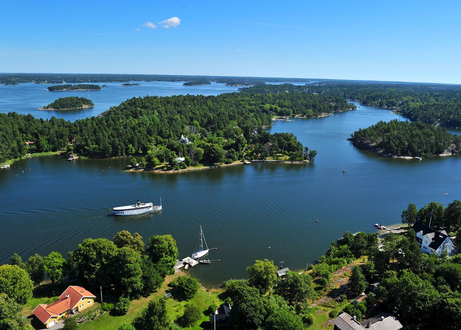
The Stockholm archipelago comprises roughly 30,000 islands, skerries, and rocks scattered across 150 kilometers of coastline. Understanding which ferry routes connect which communities determines how far you venture and what you encounter. This guide maps the primary navigation corridors and practical routing decisions for daylight excursions.
Quick answer
The stockholm archipelago boat tour route spans multiple public ferry lines operated by Waxholmsbolaget, radiating from central Stockholm to islands between 30 minutes and four hours away. The most-traveled corridors run northeast toward Vaxholm and Grinda (1-2 hours), east to Sandhamn (3.5 hours), and south to Utö and Landsort (3-4 hours). Free entry to explore the archipelago applies across all public landing points; individual boat tour prices vary by operator and route length.
The Stockholm archipelago unfolds along three primary navigation axes, each defined by depth, wind exposure, and the density of inhabited settlements. The northern corridor threads through sheltered inner waters where forested islands sit close enough to read house numbers from the deck. The eastern route crosses open stretches toward the outer skerries where granite meets the Baltic and summer cottages yield to lighthouse stations. The southern arc follows a chain of farming islands and historic pilot communities that supplied provisions and shelter before engine power made wind irrelevant. Waxholmsbolaget operates the year-round public ferry network that connects these corridors. Routes depart from Strömkajen and Strandvägen in central Stockholm, with frequencies highest between May and September when daylight extends past 21:00 and weekend traffic triples. A stockholm archipelago boat tour route to Vaxholm, the archipelago's de facto gateway, runs hourly and takes 50 minutes. Grinda and Möja lie two hours out along the same line. Sandhamn, positioned where the archipelago meets open sea, anchors the longest public route at 3 hours 20 minutes under summer schedules. Southbound lines serve Utö, a former mining island, and Landsort, home to Sweden's southernmost lighthouse. Route selection hinges on three variables: available daylight, tolerance for open water, and whether the objective is built heritage or natural landscape. Inner routes favor travelers prioritizing village architecture, farm-to-table dining, and sheltered swimming coves. Outer routes reward those drawn to exposed bedrock, seal colonies, and the horizon line where brackish water meets salt. Most operators schedule final return departures between 16:00 and 18:00, which means tours departing after 10:00 confine themselves to closer islands or risk overnight accommodation. Ferry passengers traveling beyond Vaxholm encounter a shift in both geology and infrastructure. Inner islands rest on sedimentary bedrock cloaked in pine and deciduous canopy; outer islands expose Precambrian granite scoured smooth by ice and wave action. Docks shrink from floating concrete pontoons to fixed wooden piers that require careful boarding at low tide. Mobile coverage weakens past the midpoint of most routes. Onboard facilities on longer routes include cafeterias and outdoor seating across multiple decks, while shorter shuttle services operate with minimal amenities. The archipelago remains accessible throughout the calendar, though service frequency drops sharply between October and April when ice conditions occasionally suspend routes altogether. Winter navigation restricts itself to a skeleton schedule serving year-round island residents. Summer weekend demand can fill departure slots by mid-morning, particularly on routes toward Sandhamn and Grinda during July. Advance booking through the official Waxholmsbolaget site prevents dock-side capacity disappointment and allows seat selection on upper decks where sightlines favor photography.
“The archipelago unfolds along three primary navigation axes, each defined by depth, wind exposure, and the density of inhabited settlements.”
These routes suit day-trippers and weekend explorers, from compact half-day loops to full-day island-hopping itineraries. Total durations range from 3 hours to 8+ hours depending on stops and layover choices.
Board Waxholmsbolaget ferry from Strömkajen or Nybroviken; choose a short loop (Vaxholm, 1 hour each way) or deeper routes toward Sandhamn or Grinda. Purchase tickets onboard or via app.
Disembark at Vaxholm for a 1–2 hour walk through the fortress and harbor cafés, or continue to Grinda (2.5 hours sailing) for forest trails and swimming spots. Check return schedules immediately upon arrival.
If island-hopping, catch a connecting ferry to a second destination like Möja or Finnhamn (add 1–1.5 hours sailing); short-route visitors return to Stockholm. Pack snacks—onboard kiosks are limited.
Long-route travelers explore a second island's nature reserves and villages; half-day visitors are back in the city. Reserve 30 minutes for quay waits and boarding.
Inner-archipelago routes run later.
The period from June through August offers the highest frequency of ferry departures and full island services. Visiting during the shoulder months of May or September provides a quieter experience while maintaining sufficient operational schedules.
Warm, 18°C–23°C
Full service frequency and island activity. Ideal for extended island hopping.
Mild, 10°C–15°C
Reduced passenger volume and pleasant temperatures. Most businesses remain operational.
—
Best for avoiding peak commuter and tourist volume. Provides a quieter transit experience.
Verdict: The best time for a boat tour is Tuesday to Thursday during June or August, focusing on the 09:00–16:00 arrival window.
Access to the Stockholm Archipelago is free of charge. Actual costs are determined by the specific boat transit or tour operator chosen for your journey.
Everything you need to know about stockholm archipelago boat tour route
Selecting the right path depends on your available time and interest in either central islands or the outer reaches. Many visitors prefer routes that depart from Strömkajen or Nybrokajen for immediate access to scenic waterways.
Yes, options range from classic sightseeing vessels that provide commentary to public commuter ferries used by locals. Each Stockholm boat excursion offers a distinct experience regarding vessel size, speed, and amenities.
Taking children on a boat trip is quite common and manageable, provided you plan for breaks between travel legs. Many vessels accommodate families, though packing extra snacks and layers for the maritime breeze is recommended.
Many travelers underestimate the travel time required to reach the outer islands, leading to rushed experiences. Always check the departure schedule carefully to ensure you have enough time to explore before the last boat returns.
Popular choices often include Vaxholm for its historical fortress or Sandhamn for a classic coastal atmosphere. These destinations provide a representative look at the geography and heritage of the region.
Best Archipelago Boat Tours
Read more GuideStockholm Archipelago Boat Tour Pricing
Read more GuideGetting to the Stockholm Archipelago
Read more GuideActivities in the Archipelago
Read more GuideGuide to Stockholm Archipelago Islands
Read more GuideIs a Boat Tour Worth It?
Read more Tickets & toursPrivate Archipelago Boat Tours
Read more Tickets & toursArchipelago Cruises with Lunch
Read more Tickets & toursStockholm Archipelago Winter Boat Tours
Read more